Tacloban city one of the two major city in Leyte. It is also
considered as the capital of the province. It was the first city
in Region
VIII to become a "Highly Urbanized City" and is the largest
city in terms of population in Eastern
Visayas. It is also the regional center of the Eastern
Visayas. Tacloban was briefly the seat of the Philippine Commonwealth
Government, from 20 October 1944 to 27 February 1945. Tacloban is a
tourism hub and the primary gateway to Eastern Visayas. The region is
world-renowned for its natural ecological beauty and diversity and for its
historical significance in the Second World War.
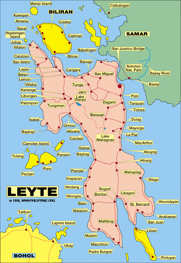
San Juanico Bridge
San Juanico Bridge, which is 2.16 kilometres
(1.34 mi) long and connects the islands of Leyte and Samar across the San
Juanico Strait, is the longest bridge in the Philippines. To many bridge
enthusiasts San Juanico Bridge is the most beautiful bridge in the country.
Santo Niño Shrine
Home of the Marcos Family, It displays the fortune and
previous properties of the first dictator of the Philippines.
People's Center Library
The library houses a collection of books of different
cultures from around the globe – USA, Europe and other countries – including
French, Spanish and English literature as well as a compilation of law books.
The People’s Center Library is used by local students as well as researchers.
Balyuan Park
Balyuan Park is located at the grounds of Magsaysay
Boulevard. The historical exchange of images between Barrio Buscada of Basey
Samar and Sitio Kankabatok, now Tacloban City. In the old days, Sitio
Kankabatok was a small barrio under the jurisdiction of Basey town in Samar.
During the Feast of Sto Niño, the residents of Sitio Kankabatok would borrow
the bigger image of the saint from the chapel of Barrio Buscada in Basey. Sto
Niño is the revered patron saint of both Kankabatok and Barrio Buscada. The
image is returned promptly after the festivities. When Kankabatok grew into a
barrio of its own, the local Catholic authorities decided that the bigger Sto.
Niño image be retained in prospering village. Stories of the image missing in
Buscada and turning up in Kankabatok aided to this decision. The Basey Flotilla
bearing the church and government leaders goes on a fluvial procession along
San Pedro Bay. A kara (shell) call announces the sight of the flotilla off Kankabatok
Bay.
Madonna of Japan
Along Magsaysay Boulevard will encounter "Madonna Maria
Kanon" (also known as: Madonna of Japan), a symbol of friendship
between the Japanese and Filipinos. It is located at the Kanhuraw Hill near
City Hall, facing Kankabato Bay. During the Second World War, the place became
a campground for the Japanese soldiers. Many inhabitants lost their lives to
help liberate the subjugated Philippine islands. Young men were forced to
become soldiers in favor of the Americans?. Women were also enjoined to
look after and take care of the young men in the battlefield. Those years
indeed brought dreadful experiences to the people of Leyte. During those years,
the Japanese soldiers were considered enemies. They were the subject of
revulsion among Filipino people. Anybody who saw Japanese would yell out in
disdain. However, as years passed, the Japanese government and its people tried
to establish comradeship with the Filipinos. Thus, Japan and the Philippines
became friends and started to support each other for progress.
Price Mansion
The Price mansion is an example of American colonial homes
built in the 1900s. It was the official residence and headquarters of General
Douglas MacArthur during the Liberation period in 1944.
Crucified Leyte
On the slope of Kanhuraw Hill is a small park with the
statue of the Crucified Leyte at its center. The same image can be found in the
provincial map of Leyte.
Santo Niño Church
The Santo Niño Church is considered the most important
religious site in the province. It houses the miraculous image of Sto. Niño
which is the patron saint of Tacloban.
Redona Residence
The Redona Residence is one of the remaining house built in
the turn of the 19th century. It is a showcase of Filipino craftsmanship, and
architecture. This historic mansion is in need of serious restoration for the
legacy of historical architecture. It was the official residence of President
Sergio Osmeña, Sr. in 1944, when Leyte was the seat of the Philippine
government during the Liberation from the Japanese campaign until Philippine
Commonwealth was re-established in Manila.
Leyte Provincial Capitol
The Leyte Provincial Capitol is a neoclassical building
built in 1907. Located at the corner of Sen. Enage Street and Magsaysay
Boulevard, the “Capitolio” is the seat of the provincial government of Leyte.
It was also the seat of the Commonwealth Government of the Philippines when
President Sergio Osmeña came in 1944 with the WW II Liberation Forces.
Popularly known as "Astrodome" is a 5,000 seat indoor
arena which is now the perfect location for basketball tourneys and other
sporting activities, concerts and other big gatherings like the Search for Ms.
Tacloban.